 Multiple Choice Questions
Which one of the following number of parallels with one degree interval can be drawn between the poles on a globe ?
180
178
179
181
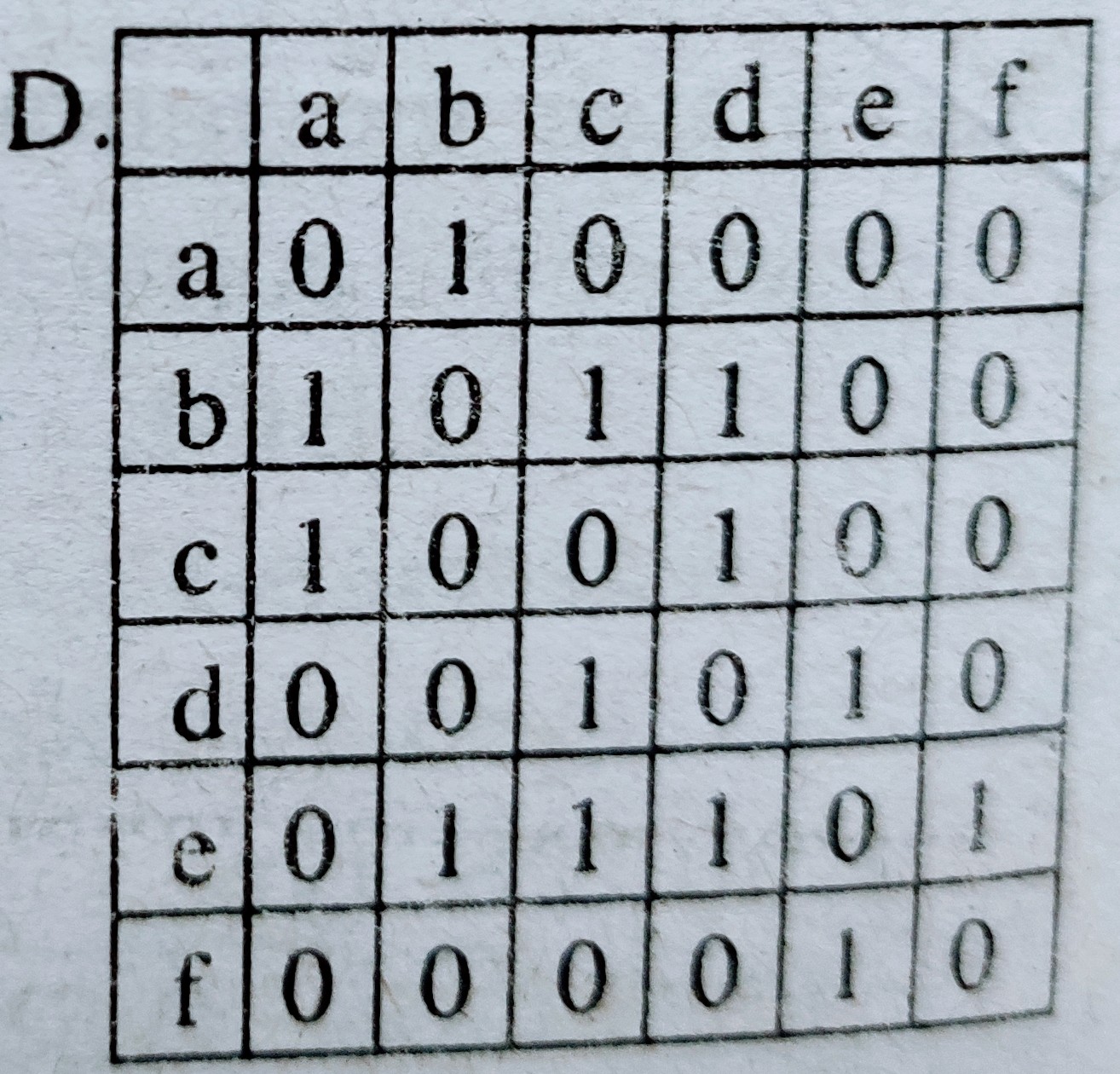
Consider the following road network diagram of an area :
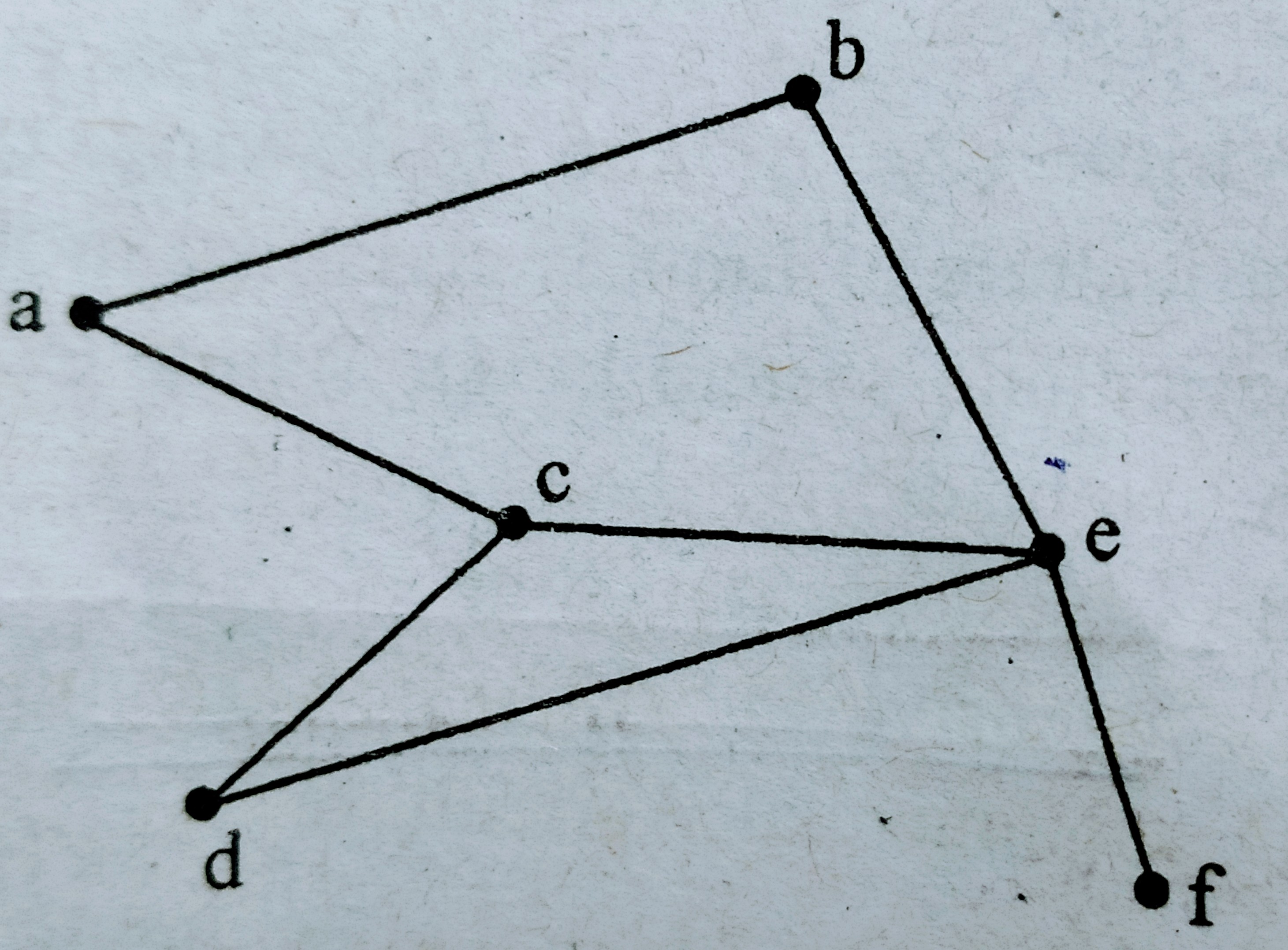
Select the correct connectivity matrix for the above network :
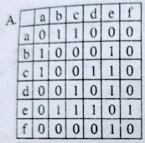
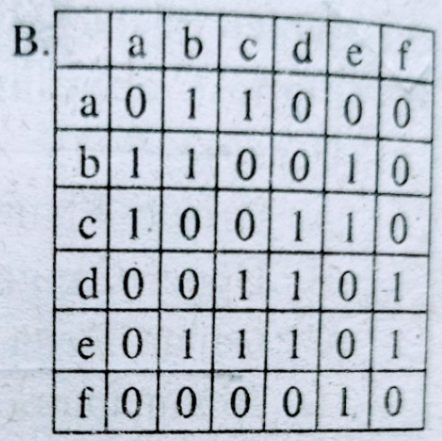
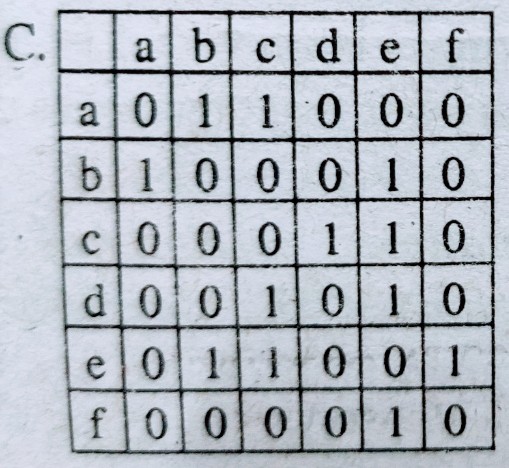
|
LIST I (Spectral Bands) |
LIST II (Wavelength) |
| (a) Visible region | (i) 8 - 12 micrometre |
| (b) Near infrared | (ii) 1 mm - 1.0 metre |
| (c) Microwave | (iii) 0.7 - 3.0 micrometre |
| (d) Thermal Infrared | (iv) 0.4 - 0.7 mircometre |
a-iv , b-ii , c-iii , d-i
a-iii , b-iv , c-i , d-ii
a-iv , b-iii , c-ii , d-i
a-iii , b-iv , c-ii , d-i
Flow maps are used to show the distribution of which type of the following data ?
Line
Area
Point
Volume
Which of the following is a GIS operation ?
Image displaying
Constrast stretching
Map over laying
Map designing
Which of the following diagrams is used to show proportion of different land uses in an area ?
Pie
Wind-rose
Line
Flow-chart
A.
Pie
Mean , median and mode coincide if the distribution of value is :
Negatively skewed
Normal
Positively skewed
Poisson
The contour interval followed is SOI Toposheet with 1/50,000 scale is :
20 metres
50 metres
100 metres
150 metres
|
LIST I (Instrument) |
LIST II (Functions) |
| (a) GPS base | (i) Distance and area |
| (b) Pantograph | (ii) 3-D vision |
| (c) Planimeter | (iii) Global location |
| (d) Stereoscope | (iv) Reduction and enlargement |
a-iii , b-i , c-iv , d-ii
a-ii , b-iv , c-iii , d-i
a-iii , b-iv , c-i , d-i
a-i , b-ii , c-iii , d-iv
