 Short Answer Type
With reference to Visveswaraya Iron and Steel Ltd., answer the following :
(i) Name the state in which it is located.
(ii) From where does it get iron ore and power supply ?
Give one important centre of production of each of the following :
(i) Integral Coach Factory (ICF)
(ii) Bharat Heavy Electrical Ltd. (BHEL)
(iii) The Hindustan Machine Tools (HMT)
 Long Answer Type
Study the extract of the Survey of India Map sheet No. 45D/10 and answer the following questions:
(a) Give the four figure grid reference of a settlement with
(i) Spot height 261
(ii) Post Office
(b) What is the difference in the pattern of drainage in grid square 1606 and in 1007 ?
(c) Name two natural features seen in grid square 0910.
(d) Calculate the distance in kilometers along the metalled road from the causeway East of Was to the distance stone 10.
(e) (i) Which is a universally accepted scale ?
(ii) State the length of the given map in kilometres.
(f) Give the six figure grid reference of:
(i) A temple South of Dhavli settlement.
(g) Which are the two different kind of roads shown in the map extract ?
(h) Mention two main occupations shown on the map extract.
(i) How are the gentle and steep slopes shown on a map ?
(j) What do the following mean ?
(i) 3r in 1103.
(ii) Open Scrub in 1502.
(k) What is the direction of Dattani and Dhavli from Chandela ?
(l) Name two man made features in grid square 1210.
(m) What do the words Motorable in dry season in grid square 1701 refer to ? What do they indicate about the rainfall received by the region shown in the map extract ?
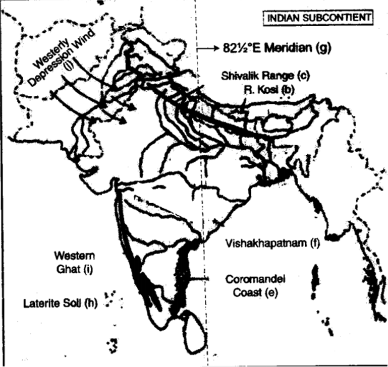
On the outline map of India provided :
(a) Mark and name Dhaka.
(b) Label the river Kosi.
(c) Shade and label the Siwalik range.
(d) Label the river Godavari.
(e) Mark and label the Coromandel coast.
(f) Mark and label Vishakhapatnam.
(g) Mark and label 82.5°E Meridian.
(h) Shade and label an area oflaterite soil in peninsular India.
(i) Mark with a bold line and name the Western Ghats.
(j) Mark with arrows the direction of the Westerly depression winds.

(a) Name the project which is a joint venture of India and Bhutan. On which river has it been constructed ?
(b) Which is the most widespread non-conventional source of power ? Give a reason for your answer.
(c) Distinguish between a Thermal power project and a Hydel power project.
(d) Why is nuclear power generation carried out on a small scale in India ?
