The convection currents are normally set up in the atmosphere as a result of local heating. The currents rise up at the centre and are drawn up at the sides. The very rapid rising of the warm moist air results in the formation of cumulonimbus clouds which may be several kilometers in depth and may give very heavy rain, but the rainfall does not last long. We speak of it as 'thunder showers' rather than thunder rain.
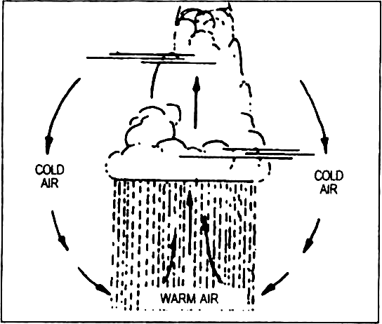
Fig. 11.3 : Convectional Precipitation
Convectional rainfall is common within the tropics, especially in the equatorial belts where it occurs almost every day in the afternoons. Similarly, the summer rain in the Steppes and Prairies is largely of this type but the amount of rainfall is low as these areas are far away from the sea.
Cyclonic rainfall or precipitation : When hot and hurried airmass meets a cloud, the warm air tries to enter the cold air at the frontal region but the cold air pushes the warm air from below. This moves the warm air on to the cold airmass and warm air begins to ascend. The water vapours of the warm humid airmass and warm airmass are condensed in the ascent of the airmass and rainfall occurs.
This rainfall is due to the convergence of air masses.
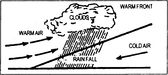
Fig. 11.4 : Cyclonic Precipitation
There is a low pressure area at the centre of cyclones. The air from the surrounding high pressure area moves encircling towards the centre. This air does not find place to stay at the centre due to the cyclonic rotation and therefore has to rise in the atmosphere. Condensation by ascent causes rainfall.


