
Draw the conventional signs and symbols for the following features :
(i) International Boundary (ii) Bench Mark (iii) Villages (iv) Metalled Road (v) Footpath with Bridge (vi) Places of Worship (vii) Railway line.

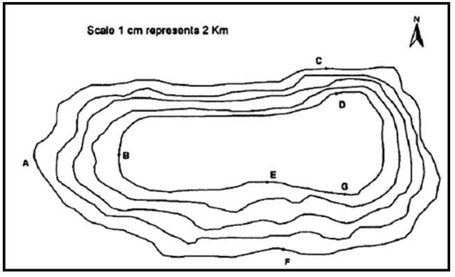
Study the contour pattern and answer the following questions :
1. Name the geographical feature formed by contours.
2. Find out the contour interval on the map.
3. Find out the map distance between E and F and convert it into the ground distance.
4. Name the type of slope between A and B; C and D and E and F.
5. Find out the direction of E, D and F from G.
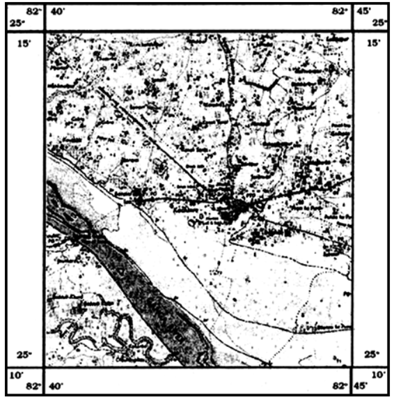
Study the extract from the topographical sheet No. 63K/12, as shown in the figure below and answer the following questions :
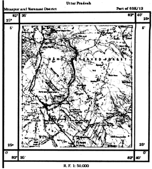
Study the extract for topographical sheet 63K/12 shown in the figure below and answer the following questions :
The next information will be derived about human settlements. This information will indicate the occupation, the land use etc., we will come to know that how many urban centres and industrial centres are there? How dense are the rural settlements? Are they uniformly distributed ? Nucleated settlements with uniform
distribution occur in relatively flat alluvial plains as in Uttar Pradesh. Along the coastal plains in Kerala we find linear pattern of settlements following old sand dense parallel to the coast.


 Switch


